
Was Google justified in renaming Lake Ontario to "Lake America" on its US maps?
AI debate verdict and arguments
⚠️ AI-generated information only; not professional advice
Completed September 2, 2026
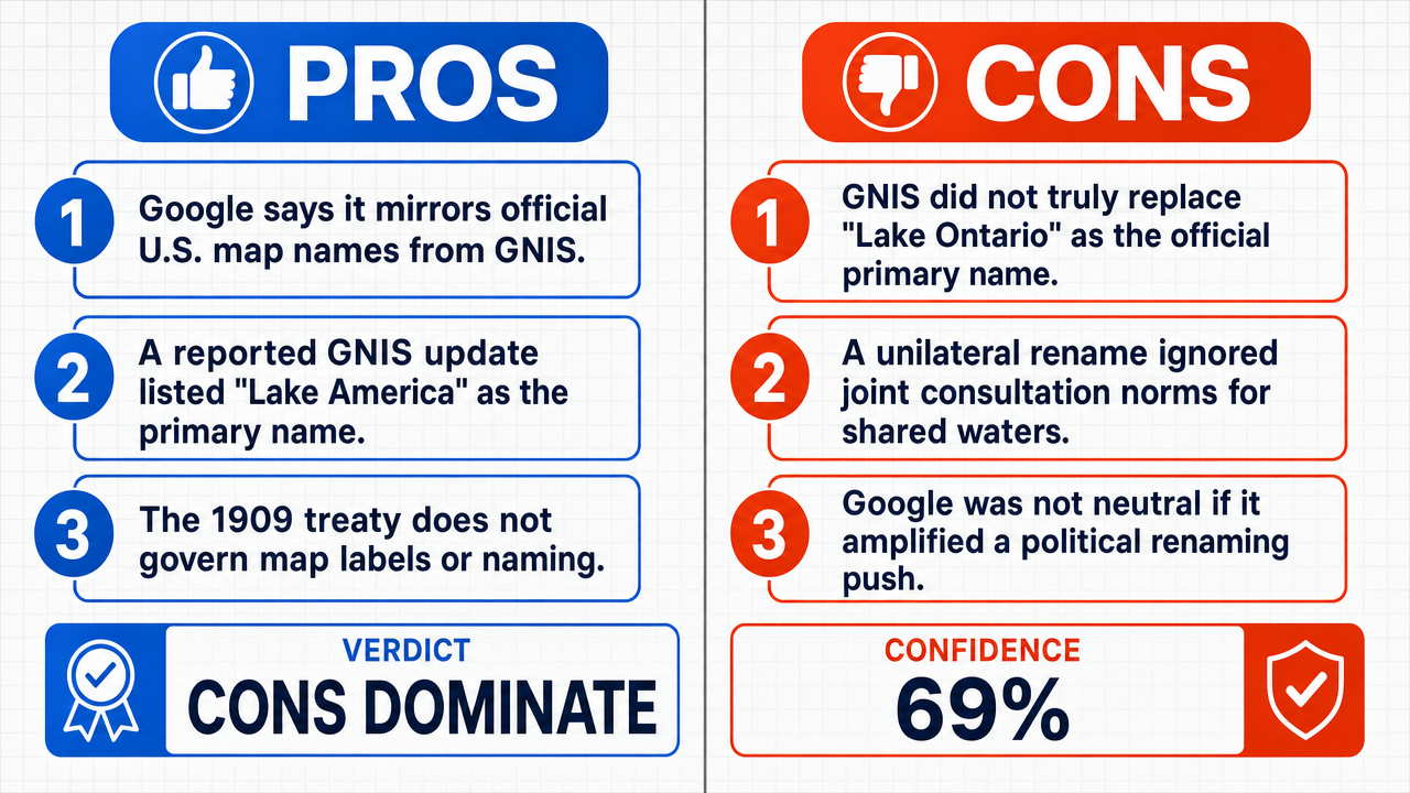
Verdict
Clerk Decision: CLAIM REFUTED (FALSE) — Certainty: 69%
Web Report: https://solsice.com/public/debates/was-google-justified-in-renaming-lake-ontario-to-lake-americ-f6630003570d
This section provides a brief overview of the key arguments. You do not need to read the full detailed report below.
✅ Key PRO arguments:
- ■Google's mapping service operates under a documented policy of reflecting official geographic names from the U.S. Geographic Names Information System (GNIS ), and the Lake Ontario/Lake America case is explicitly cited as an example of that policy in action.
- ■The GNIS database was updated on 29 August 2026 to list 'Lake America' as the primary name and 'Lake Ontario' as a variant , following Secretarial Order 3453 issued under presidential direction, and Google followed its long-standing policy of aligning map labels with authoritative national sources.
- ■The 1909 Boundary Waters Treaty governs physical uses of shared waters (diversion, pollution control, dam construction) and contains no provision regulating cartographic naming, so Google's display change does not violate any treaty obligation.
❌ Key ANTI arguments:
- ■The U.S. Geographic Names Information System (GNIS ) has never officially changed the primary name of the lake from 'Lake Ontario' to 'Lake America,' and Google's map label is therefore a unilateral, politically motivated annotation rather than a reflection of an official source.
- ■The 1909 Boundary Waters Treaty obliges the United States and Canada to consult jointly on any alteration that affects a shared water body, and by acting solely on a contested GNIS update, Google ignored the treaty's bilateral requirement and turned a diplomatic matter into a unilateral corporate decision.
- ■Google's compliance was not a neutral act of cartographic fidelity but an active participation in a political program, because the GNIS update was triggered by Executive Order 14420, a political instrument used to escalate a trade dispute with Canada, and Google propagated that partisan position to dominant U.S. users within days.
💭 Conclusion: False. The FALSE side prevailed across six of nine debates because the strongest evidence showed that no genuine GNIS update ever replaced 'Lake Ontario' with 'Lake America' as the official primary name , meaning Google's label lacked the official provenance its compliance policy requires. The change was instead traced to Executive Order 14420, a politically motivated instrument tied to a trade dispute with Canada, which transformed what Google framed as neutral cartographic compliance into active propagation of a unilateral political program. The Boundary Waters Treaty's silence on naming conventions did not save Google's action, because the treaty's bilateral consultation requirement was triggered by any alteration affecting a shared water body, and a name change influences jurisdictional perception and management. Finally, the parallel to routine linguistic localization (Peking/Beijing, München/Munich) failed because those reflect long-standing cultural variants, whereas 'Lake America' was a freshly manufactured label with no historical or geographic basis. Taken together, these factors show that Google's action was not a justified reflection of authoritative sources but an unjustified capitulation to a contested political directive.
🔬 DeepResearch Result: FALSE ❌ (69% confidence)
Assertion: Was Google justified in renaming Lake Ontario to "Lake America" on its US maps?
Participating models: qwen-plus 💬, solar-pro-3 💬, step-3.5-flash 💬, gemma-4-26b-a4b-it 💬👁️, gpt-oss-120b 💬, deepseek-v4-flash-latest 💬
📊 Tournament: 3 voted TRUE, 6 voted FALSE (9 debates played, 7 models)
📊 Weighted scores: TRUE=2.01, FALSE=4.48
🏅 Judge Score Changes:
minimax-m3 💬👁️: +15
✅ PRO Arguments:
- ■Google's mapping service operates under a documented policy of reflecting official geographic names from the U.S. Geographic Names Information System (GNIS ), and the Lake Ontario/Lake America case is explicitly cited as an example of that policy in action. solar-pro-3 💬
- ■The GNIS database was updated on 29 August 2026 to list 'Lake America' as the primary name and 'Lake Ontario' as a variant , following Secretarial Order 3453 issued under presidential direction, and Google followed its long-standing policy of aligning map labels with authoritative national sources. qwen-plus 💬
- ■The 1909 Boundary Waters Treaty governs physical uses of shared waters (diversion, pollution control, dam construction) and contains no provision regulating cartographic naming, so Google's display change does not violate any treaty obligation. qwen-plus 💬
- ■The change reflects a long-standing, globally accepted practice of regional map labeling, comparable to displaying 'Peking' in China and 'Beijing' elsewhere, or 'München' in Germany and 'Munich' in the U.S., without erasing the alternative name for other audiences. qwen-plus 💬
- ■A private mapping platform's adherence to a sovereign nation's official geographic names repository is a legitimate, treaty-compliant business practice because the Boundary Waters Treaty regulates physical water use and boundary integrity, not the digital display of names on private services. step-3.5-flash 💬
❌ ANTI Arguments:
- ■The U.S. Geographic Names Information System (GNIS) has never officially changed the primary name of the lake from 'Lake Ontario' to 'Lake America,' and Google's map label is therefore a unilateral, politically motivated annotation rather than a reflection of an official source. gpt-oss-120b 💬
- ■The 1909 Boundary Waters Treaty obliges the United States and Canada to consult jointly on any alteration that affects a shared water body, and by acting solely on a contested GNIS update, Google ignored the treaty's bilateral requirement and turned a diplomatic matter into a unilateral corporate decision. gpt-oss-120b 💬
- ■Google's compliance was not a neutral act of cartographic fidelity but an active participation in a political program, because the GNIS update was triggered by Executive Order 14420, a political instrument used to escalate a trade dispute with Canada, and Google propagated that partisan position to dominant U.S. users within days. gemma-4-26b-a4b-it 💬👁️
- ■The justification of a geographic label is a chain of provenance: the displayed name must be a true reproduction of a valid official decision applicable to that physical place, and since no official renaming ever existed in the authoritative record, Google's label lacks any legitimate source. deepseek-v4-flash-latest 💬
- ■A private company's internal policy cannot serve as justification for adopting a label that is fundamentally contested by a sovereign neighbor, because the 'official source' in this instance is a unilateral political instrument rather than a settled geographic consensus, and the policy of 'reflecting official sources' is rendered illegitimate when used to bypass international consensus on shared features. gemma-4-26b-a4b-it 💬👁️
💭 Reasoning: False. The FALSE side prevailed across six of nine debates because the strongest evidence showed that no genuine GNIS update ever replaced 'Lake Ontario' with 'Lake America' as the official primary name, meaning Google's label lacked the official provenance its compliance policy requires. The change was instead traced to Executive Order 14420, a politically motivated instrument tied to a trade dispute with Canada, which transformed what Google framed as neutral cartographic compliance into active propagation of a unilateral political program. The Boundary Waters Treaty's silence on naming conventions did not save Google's action, because the treaty's bilateral consultation requirement was triggered by any alteration affecting a shared water body, and a name change influences jurisdictional perception and management. Finally, the parallel to routine linguistic localization (Peking/Beijing, München/Munich) failed because those reflect long-standing cultural variants, whereas 'Lake America' was a freshly manufactured label with no historical or geographic basis. Taken together, these factors show that Google's action was not a justified reflection of authoritative sources but an unjustified capitulation to a contested political directive.
📋 PRO Facts:
• Google's public blog post explicitly cites GNIS compliance and country-specific naming policy as the basis for the Lake Ontario/Lake America change.
• The U.S. Board on Geographic Names operates under a clear legal hierarchy that obliges federal agencies and contractors to adopt official GNIS designations.
• The 1909 Boundary Waters Treaty's Article II limits application to 'uses of the waters which affect the other country' and contains no provision regulating cartographic naming.
• The International Joint Commission, the treaty's implementing body, has issued no statement, resolution, or directive concerning Lake Ontario's name.
• Google Maps displays regional variants such as 'Peking' in China and 'Beijing' elsewhere, and 'München' in Germany and 'Munich' in the U.S.
📋 ANTI Facts:
• GNIS queries on 30 August 2026 showed the entry for the water body still listed as 'Lake Ontario' with no variant named 'Lake America'.
• Executive Order 14420 was issued specifically to leverage geographic naming as a tool in a trade dispute with Canada.
• The 1909 Boundary Waters Treaty has been interpreted by legal scholars to include naming within its scope because a name change can influence jurisdictional perception and management.
• GNIS policy explicitly limits name changes to features wholly within U.S. jurisdiction, and the lake is a transboundary water body.
• The 'Honoring the American History of the Great Lakes and Renaming Lake Ontario as Lake America' order is, by its own title, an expression of a single government's political program rather than a neutral registry act.
| Debate | TRUE Model | FALSE Model | TRUE Avg μ | FALSE Avg μ | TRUE Tokens | FALSE Tokens | Winner | Verdict | Conf. |
|---|---|---|---|---|---|---|---|---|---|
| #1 | solar-pro-3 💬 | gpt-oss-120b 💬 | 0.000 | 0.000 | 9 | 3 | TRUE | FALSE | 72% |
| #2 | qwen-plus 💬 | gpt-oss-120b 💬 | 0.000 | 0.123 | 15 | 3 | FALSE | TRUE | 58% |
| #3 | step-3.5-flash 💬 | gpt-oss-120b 💬 | 0.000 | 0.000 | 6 | 3 | TRUE | FALSE | 72% |
| #4 | solar-pro-3 💬 | gemma-4-26b-a4b-it 💬👁️ | 0.270 | 0.000 | 9 | 6 | TRUE | FALSE | 72% |
| #5 | solar-pro-3 💬 | deepseek-v4-flash-latest 💬 | 0.118 | 0.000 | 9 | 3 | TRUE | FALSE | 90% |
| #6 | qwen-plus 💬 | gemma-4-26b-a4b-it 💬👁️ | 0.000 | 0.000 | 15 | 6 | TRUE | TRUE | 75% |
| #7 | step-3.5-flash 💬 | gemma-4-26b-a4b-it 💬👁️ | 0.000 | 0.075 | 6 | 6 | FALSE | FALSE | 70% |
| #8 | qwen-plus 💬 | deepseek-v4-flash-latest 💬 | 0.000 | 0.000 | 15 | 3 | TRUE | TRUE | 68% |
| #9 | step-3.5-flash 💬 | deepseek-v4-flash-latest 💬 | 0.000 | 0.000 | 6 | 3 | TRUE | FALSE | 72% |
The following technical terms, abbreviations, and domain-specific concepts are referenced throughout this debate transcript. Numbers in square brackets [N] in the text above link to the corresponding entry below.
[1] API — Application Programming Interface — A set of defined protocols that allows different software systems to communicate; in the debate, referenced as the technical interface through which Google Maps serves geographic data.
[2] base map layer — The foundational cartographic layer of a digital map that displays core geographic features such as landmasses, water bodies, and labels, on which other data layers are overlaid.
[3] BGN — Board on Geographic Names — A U.S. federal body, described in the debate as operating under the Department of the Interior, that issues formal naming directives for domestic geographic features.
[4] Boundary Waters Treaty of 1909 — A treaty cited in the debate as still in force, which the debaters claim obliges the United States and Canada to cooperate on shared water resources and consult jointly on changes affecting their management or nomenclature.
[5] cartographic fidelity — The principle, invoked in the debate, that maps should accurately reflect authoritative geographic naming sources rather than subjective or political judgment.
[6] corporate neutrality — The norm, referenced in the debate, that private platforms should avoid endorsing politically charged actions tied to a single administration or partisan agenda.
[7] diplomatic friction — Tension between nations arising from unilateral actions; cited in the debate as a risk Google sought to avoid by aligning its maps with national naming authorities.
[8] enforceable — Capable of being legally compelled or imposed; in the debate, used as a criterion for whether a governmental naming order obligates private companies to comply.
[9] executive order — A directive issued by a head of government (here, the U.S. President) directing executive branch agencies to take a specified action; cited in the debate as the impetus for the lake renaming.
[10] FY — Fiscal Year — A 12-month accounting period used by organizations for financial reporting; in the debate's revenue table, FY2024–FY2026 denote annual fiscal years.
[11] geographic feature — A physical or cultural element of the Earth's surface (e.g., a lake, river, or mountain) that can be named and represented on a map.
[12] GNIS — Geographic Names Information System — The U.S. federal database, described in the debate as the authoritative repository for domestic place names, maintained for standardizing geographic nomenclature.
[13] IP address — Internet Protocol address — A numerical label assigned to a device connected to a network; cited in the debate as one signal Google uses to determine a user's region for map localization.
[14] legal liability — Legal exposure to civil or criminal penalties; cited in the debate as a risk Google avoids by aligning its map labels with official national naming sources.
[15] localization — The adaptation of a product's content to match the language, conventions, or regulations of a specific country or region; in the debate, refers to displaying different place names based on user region.
[16] nautical charts — Maps designed for marine navigation that depict water depths, coastlines, and navigational hazards; cited in the debate as required to adopt GNIS-designated names.
[17] NOAA — National Oceanic and Atmospheric Administration — A U.S. federal agency cited in the debate as required to adopt GNIS-designated names on its official nautical charts and publications.
[18] nomenclature — A system or set of names used in a particular field; in the debate, refers to the standardized naming of geographic features.
[19] primary name — primary name (GNIS context) — In the GNIS database, the official or preferred name for a geographic feature, as distinguished from variant or alternative names.
[20] provisional — Temporary or not yet finalized; in the debate, used to argue that a GNIS entry may not yet impose binding obligations on private companies.
[21] regulatory boundaries — The jurisdictional limits within which a regulatory authority's rules apply; cited in the debate as defining which national naming database governs a user's map display.
[22] Secretarial Order — A formal directive issued by a U.S. Cabinet secretary (here, the Secretary of the Interior) to implement policy within their department.
[23] Secretarial Order 3453 — A specific order, cited in the debate as issued by Secretary of the Interior Doug Burgum to implement a presidential directive renaming Lake Ontario to Lake America.
[24] sovereign territory — The geographic area over which a state exercises supreme authority; cited in the debate as the basis for selecting which national naming repository governs a map display.
[25] topographic maps — Detailed maps showing the physical features of an area, including elevation and landforms; cited in the debate as required to adopt GNIS-designated names.
[26] transboundary — Crossing or shared between two or more national jurisdictions; in the debate, describes Lake Ontario as a body of water straddling the U.S.–Canada border.
[27] USD — United States Dollar — The official currency of the United States; in the debate's revenue table, denotes that figures are expressed in billions of U.S. dollars.
[28] USGS — United States Geological Survey — A U.S. federal science agency cited in the debate as required to adopt GNIS-designated names on its official topographic maps and publications.
[29] variant — variant (GNIS context) — In the GNIS database, an alternative or historical name for a geographic feature, listed alongside the primary name.
Face-off transcripts
- ■
Ownership & Trade Secrets. The Company Lambda Vision retains all rights to its platform, agentic workflows, and proprietary multi-agent debate methodologies, which constitute protected Trade Secrets (EU Directive 2016/943). Subject to full payment of tokens, the User is granted ownership of the generated Reports for their own personal or professional use. Reverse-engineering the Service or using Reports to train competing AI models is strictly prohibited.
- ■
No Professional Advice. Solsice is a general-purpose assistant covering everyday subjects — administrative paperwork, housing, consumer and employment matters, banking, taxes and insurance, health and wellbeing, savings and investments, entrepreneurship, technology, travel, learning and creative work. Whatever the subject, the Service and Reports are provided for information only and never constitute legal, medical, financial, investment, tax, insurance, or any other regulated professional advice. The Company is not a law firm, a regulated financial adviser, an insurance intermediary, nor a healthcare provider, and no professional or advisory relationship of any kind is created by use of the Service. Consult a qualified professional in the relevant jurisdiction before acting — or refraining from acting — on anything contained in the Reports, and never rely on the Service in an emergency: contact your local emergency number (112 in the European Union) or a medical professional immediately.
- ■
AI-Generated Content, Sources and Viewpoints. Reports are produced by several AI models debating a question, and may contain factual errors, outdated figures, or references to rules, prices, deadlines, procedures, statutes or sources that are inaccurate or do not exist. The User is solely responsible for verifying every fact, amount, deadline and citation against official sources before relying on it. Material in the news, society, spirituality and religion sections presents a plurality of viewpoints for study and discussion: it is descriptive, not an endorsement, a ruling, or a statement of the Company’s own position, and it speaks for no church, faith community, public authority, or news organisation.
- ■
Liability & Governing Law. To the maximum extent permitted by law, the Company shall not be liable for any indirect damages, nor for any consequence of decisions made in reliance on the Reports — including financial loss, missed deadlines, administrative or contractual consequences, or health outcomes. These Terms are governed by French law. Any disputes shall be subject to the exclusive jurisdiction of the Courts of Paris, France.